SignProx
SignProx is an inventory and management system for highway signs created by transportation engineers for agencies that maintain traffic control devices. SignProx will provide insight into current sign needs and utilization, as well as drive optimizations in sign maintenance and safety.
SignProx provides easy methods to collect sign data, including GPS integration. All data is stored and maintained in a database that can be accessed by popular GIS tools. SignProx also provides reporting capabilities to allow quick determination of what signs are in compliance with policies, what signs need to be repaired or replaced.
Best of all? SignProx is now being freely offered through the Traffic and Safety Program at the Kentucky Transportation Center.
Why SignProx?
SignProx Helps You Be Compliant
SignProx drives efficiencies in maintaining and optimizing a collection of highway signs and is designed to ensure compliance with the sign retroreflectivity mandate from FHWA:
“Agencies have until June 14, 2014 to implement and continue to use an assessment or management method that is designed to maintain regulatory and warning sign retroreflectivity at or above the minimum levels in Table 2A-3 of the 2009 MUTCD.”

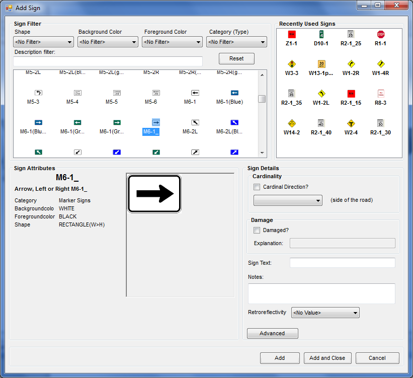
Hundreds of preloaded MUTCD signs - or use your own!
- Use data you have already collected in other programs; free data conversion
- MUTCD standard signs are contained in a filterable and searchable database including a preview image
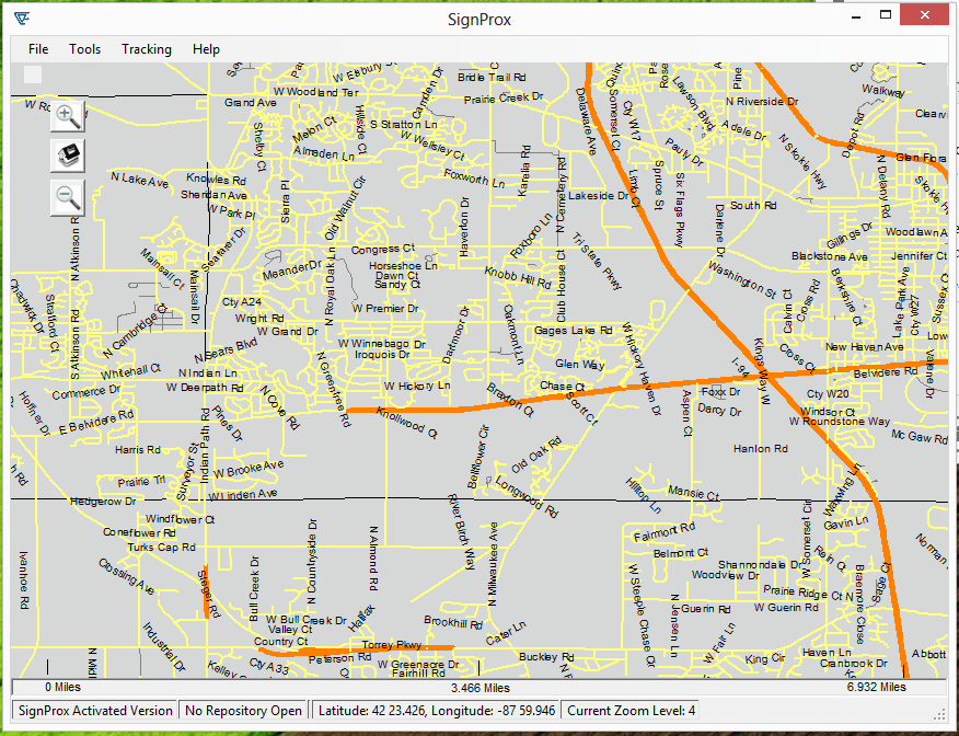
Collect data using a GPS-enabled camera or smart phone
- No expensive hardware required. Use a GoPro camera or a smartphone.
- Connect to a GPS unit to track location.
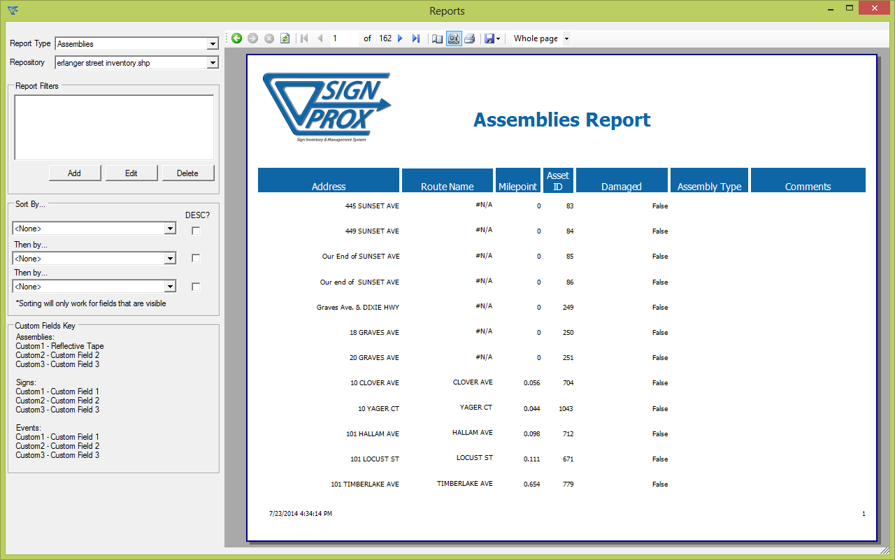
Create reports on collected data
- Create reports on collected data and filter reports based on common criteria such as road name and sign type
- Print reports or export to Excel, Microsoft Word, or PDF
- Cut, Copy, and Paste complex sign arrangements
Fill out this form to get a download link for the SignProx software!
